Frontier pioneers high-resolution imagery to aid agronomy decision making
As part of its continuing drive to develop digital solutions for farmers, precision agronomy specialist Frontier Agriculture is developing a range of cutting edge support tools guided by high resolution imagery.
The images are supplied by Spectrum Aviation and gathered using aeroplanes fitted with multiple-sensor payloads.
For a number of years Frontier’s agronomists and their farmer customers have had access to imagery from satellites and drones which have been used to aid variable rate application of inputs. The difference offered by Spectrum is their ability to rapidly gather and analyse high resolution imagery over much larger areas, covering up to 10,000 ha per aircraft per day. The high level of detail enables earlier analysis of crop performance to support early management decisions. The resulting images can be used alongside other precision data layers in MySOYL, part of Frontier’s farm management platform MyFarm.
Frontier agronomists are then able to use this data on farm to help guide their field walking activity and to monitor field trends, as well as to guide variable rate applications.
High resolution data gathered using remote sensors is in use by several Frontier agronomists and their farmer customers. Jeremy Nicholson is one of Frontier’s agronomists using the new tools and said: “We’re constantly seeking to produce a crop that is even in terms of biomass as we believe adequate and even levels of biomass in a crop’s early stages is a good indication of potential yield at harvest. Consequently, more detail at the earliest possible stage in the growing season is extremely useful.
“This new imagery enables us to identify where we may have an uneven crop in a particular area of the field as early as September. We can use the images gathered by aeroplanes to introduce a system of early intervention which, for example, could support biomass or root development where a crop might be struggling in a particular part of the field.
“One example this year is in one of my customer’s oilseed rape crops where we were able to fly the field and create maps as early as the first week of September (2 leaf stage). This gave an early indication of potential problem areas in his field. Where the crop was visibly backwards I will focus more of my field walking time on that area this season, and in future we may try targeted applications of micronutrients or biostiumlants to try and manipulate root and canopy development.
“The images may well help guide variable rate application of inputs such as PGRs and nitrogen but I expect the targeting of my agronomy decisions and field walking activity to be the real benefit.”
Frontier anticipates that this level of detail could be used in an arable situation to gather images once or twice in the autumn and two or three times in the spring. This could then be supplemented in the intervening periods by regular weekly satellite images.
Andrew Flux, commercial strategy director for Frontier added: “Early feedback from the agronomists taking part in this pilot is excellent. We intend to provide our agronomists with the most accurate and detailed data possible to support the advice they give to farmers and help them make decisions on where to focus resources. This use of high resolution imagery will take the use of data in agronomy to the next level, adding value for our farmer customers. ”
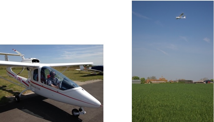
Spectrum Aviation’s aeroplanes can gather high resolution imagery covering up to 10,000 ha per aircraft per day.
MyFarm is Frontier’s farm management platform enabling farmers to manage all aspects of their business.
MySOYL is a web-based precision management tool used to store, view and analyse farm data, part of the MyFarm platform
About Spectrum Aviation
Spectrum Aviation is an aerial survey and informatics company, specialising in agricultural vegetation analysis for precision agriculture. Their vision is that remote sensing will rapidly become a routine and indispensable agronomic tool, used across the industry to contribute to holistic farm management practices at tactical in-season and longer-term strategic levels.
Spectrum actively delivers practical crop imaging applications that add value to agricultural businesses. Their core capabilities span sensor payload design and certification, data gathering, in-house image and data processing, through to derived product delivery. Interpretation and diagnostic follow-up can be provided by Spectrum’s independent agronomist partners, or linked into existing customer agronomy service provider networks.
Follow Spectrum Aviation on Twitter: @SpecAviation